Hello, welcome to GeoRangeSurveys. How may we help you?
Hello, welcome to GeoRangeSurveys. How may we help you?
Professional land suveying, topographical & engineering survey services across Kenya, delivering accurate data for smarter planning and seamless project execution.
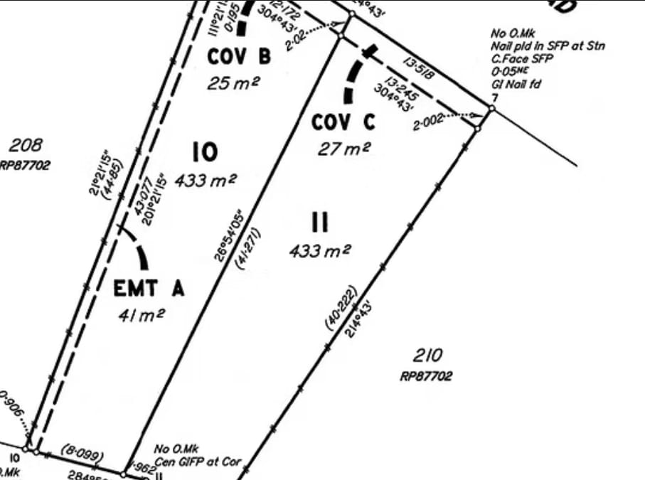
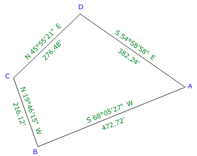
Subdivision and cadastral surveys provide precise measurements for dividing land into plots and establishing property boundaries. Its entails marking boundaries with baecons and getting approvals from planning and land control boards to produce new legally recognised title deeds.
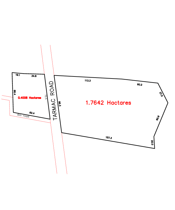
Boundary surveys provide precise measurements to determine property lines for the purpose of resolving disputes, preparing for building, verifying acre range through field measurement and setting physical marks to establish land ownership.
Accurate topographic mapping is essential for various industries, from construction to environmental management. Our topographic mapping services provide detailed and precise information about the elevation, contours, and features of the land, enabling you to make informed decisions and plan your projects effectively.
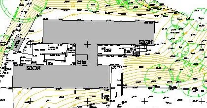
Our engineering and construction surveys are tailored to meet the needs of both public and private sector clients. We provide comprehensive surveying services to support land development, infrastructure projects, and construction activities. Our team ensures that your projects are built on a strong foundation of accurate survey data.
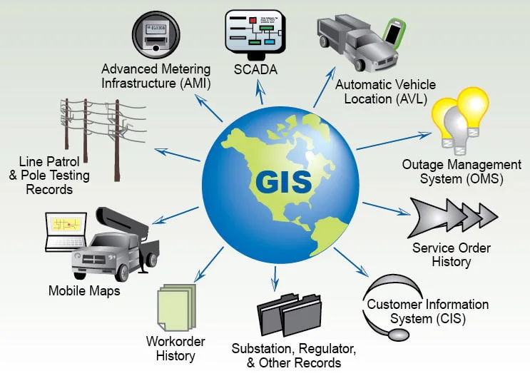
Harness the power of geographic information systems (GIS) to visualize, analyze, and interpret spatial data. Our GIS solutions provide valuable insights for urban planning, environmental monitoring, transportation management, and more. Unlock the potential of location-based data with our expertise.
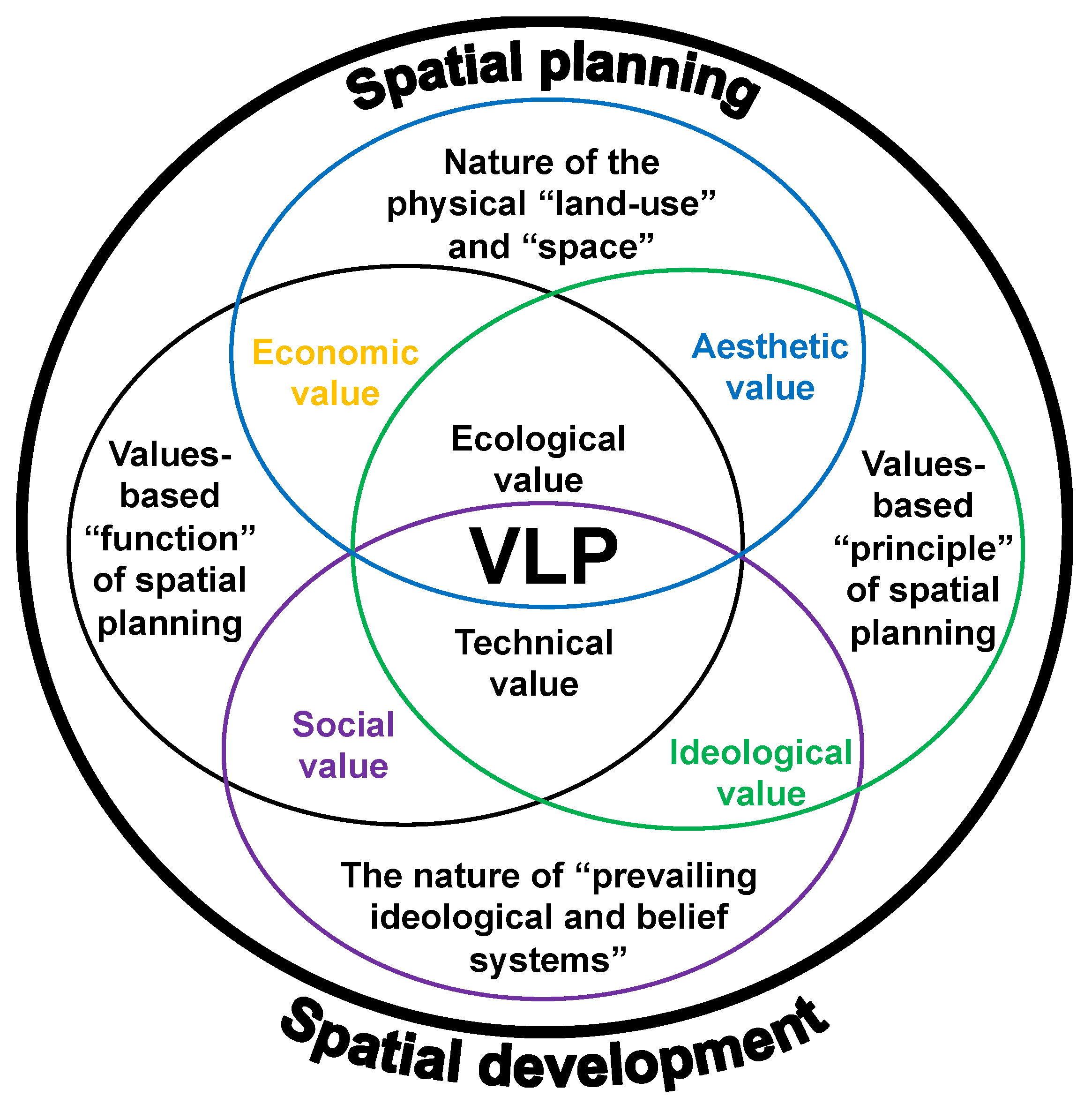
Spatial planning involves optimizing land use and development to create efficient and sustainable environments. Our spatial planning services focus on designing spaces that promote economic growth, social well-being, and environmental preservation.
Remote sensing technology allows us to gather data from a distance, making it invaluable for monitoring large areas. We offer remote sensing services that capture essential data for environmental studies, agriculture, and disaster management.
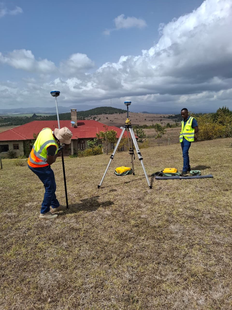
Geodetic GPS control surveys provide precise positioning data for large-scale mapping and construction projects. Our surveys ensure accurate measurements for infrastructure development, land management, and engineering applications.